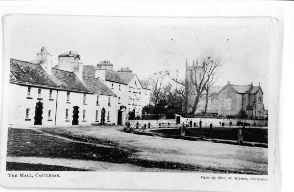
The Mall c1900 Courtesy of the Wynne Collection
|
Collins English dictionary describes a mall as ‘a shaded avenue, esp one that is open to the public’. However, examination of Ordnance Survey Maps shows it was designed by the Bingham’s as a part of a walkway that led directly from Lawn House to the Anglican Church at Mountain View. This part of Castlebar became known as ‘The Green’ as the land was reclaimed from a marshy area to expand the Bingham gardens by John Bingham. It was a meeting place for the gentry and also a place of execution. Describing life in Castlebar in the eighteenth century, Mary Mc Carthy writes ‘At night the inhabitants were afraid to go by the mall when a corpse was swinging from the gibblet; but in the daytime it was quite usual for people to pass under a dead felon’. There is a distinction between the Mall specifically the walkway and the Green or the grass area. Most residents today refer to the entire area as the Mall. The area is home to many of the most important buildings of the town. A look at the Ordnance Survey Maps shows that in the 1890s were located the Anglician and Methodist Churches, Bank of Ireland, the Military Barracks, the Court House, the Infirmary and the Post Office. 50 years before that, it also housed the goal and the hospital. Today the area houses government buildings as well as the new Garda Station. Click here for Castle Street. |
